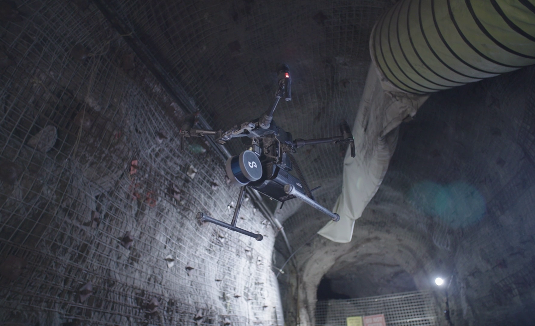


First launched in 2019, Hovermap is a proven light detection and ranging mapping and autonomy platform used in environments with no global positioning system capacity.
It is used to map challenging and dangerous environments, including problematic stopes in deep mines and ground impacted by seismic events.
Hovermap uses a SLAM-based system for rapid mapping that works well in some environments. However, it struggles with survey grade accuracy and repeatability.
To fix this Emesent's latest version, the Hovermap ST, has an automated ground control feature that removes SLAM drift to provide more accurate and faster data capture capacity.
Ground control targets are put down and captured in one continuous scan with Hovermap ST, with no need to stop or position Hovermap on the targets that are automatically detected by the SLAM processing engine and georeferenced to the point clouds.
The whole platform has essentially been redesigned from the ground up and features a lightweight, IP65 weather sealed design, a powerful embedded computer for autonomy and mapping and an accessory expansion port.
The rotating LiDAR produces up to 600,000 points per second in dual return mode, with a tap-to-fly autonomy feature allowing guided exploration in previously inaccessible areas beyond line of sight and communication range.
The new version also has omnidirectional collision avoidance and smart return-to-home functions to avoid damage or loss.
Emesent CEO and co-founder Dr Stefan Hrabar said the company was excited to be providing customers with a robust and reliable autonomous mapping tool for challenging environments, including those previously not well suited to SLAM-based mapping.
"This is a huge step forward for mobile mapping, providing unrivaled SLAM accuracy and workflow efficiencies," he said.